-
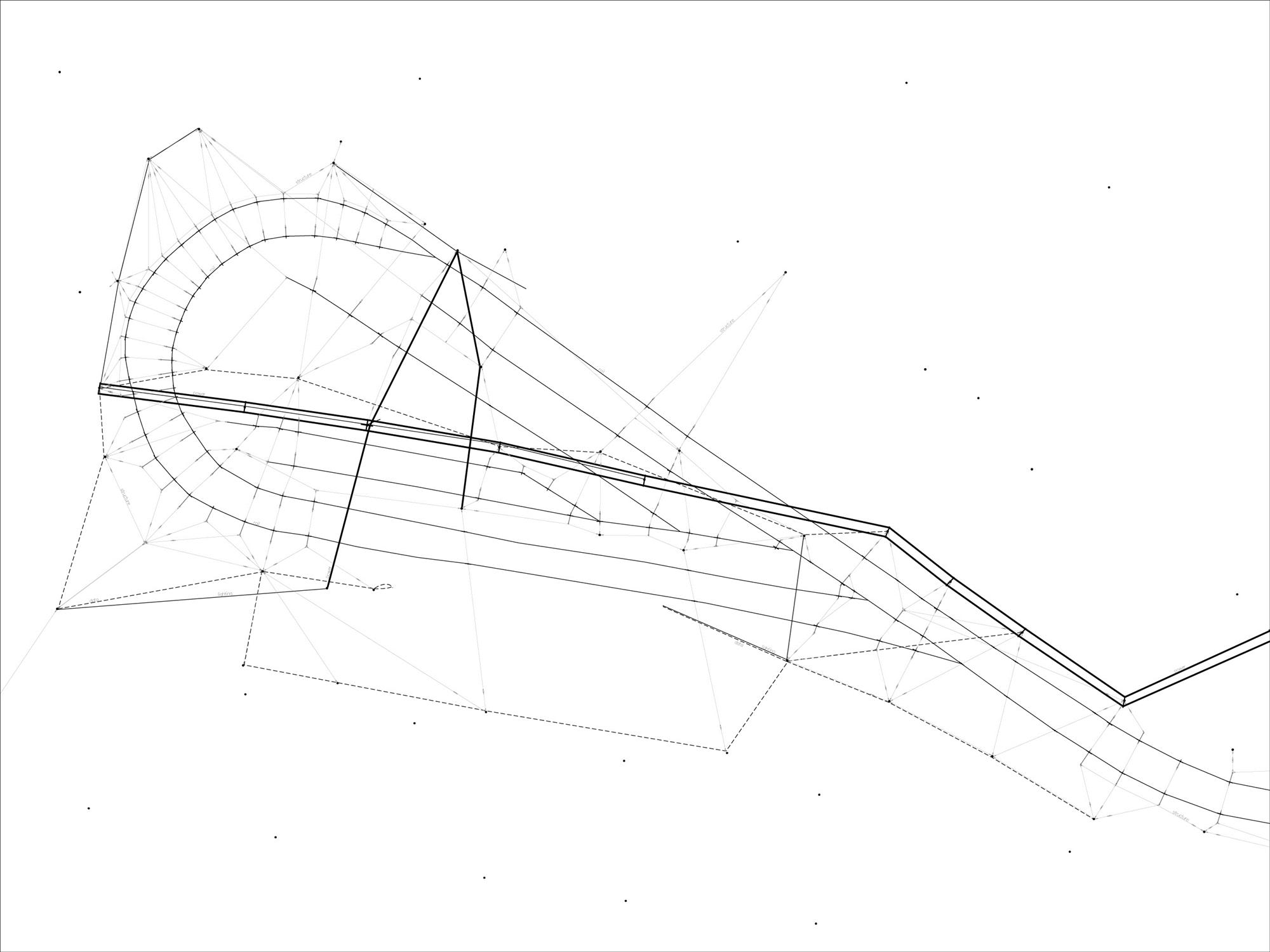
One of the aspects of the site that I found fascinating was the network of cables used to power the tram. This drawing is a mapping of all of the cables on the site including their function and connection types.
-
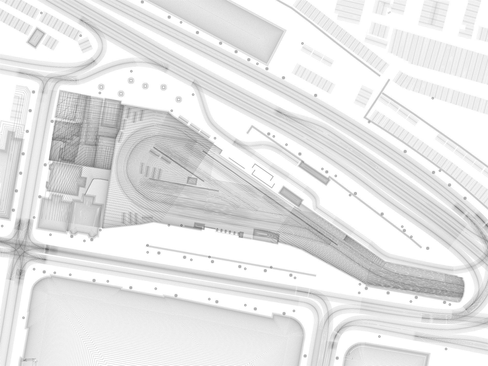
This drawing explores all of the different kinds of barriers on the site: chain-link fences, iron bar fences, wood fences, brick walls, trains, parked cars, etc. The drawing shows the effect of those barriers on where pedestrians can go in the site, using only parallel lines. As the lines cross and overlay they reveal areas which are affected by more barriers and are thus harder to access.
-
In this drawing each line corresponds to a possible walking path through the site. Dashed lines represent stationary people in moving vehicles. As the lines build up into flows barriers in the site are described by the remaining white space.
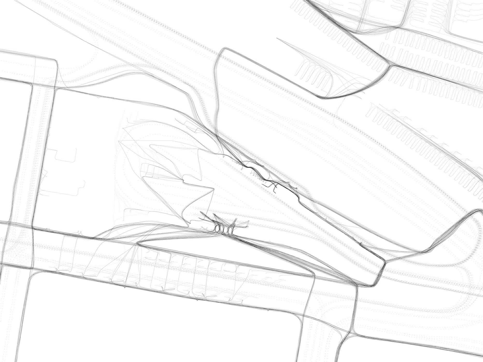
Three site studies of a train and bus station in Cambridge, MA. These studies led to the development of the Labyrinth.